
Файл:Australia Northern Territory location map.svg

Файлым и къежьапӀэр (SVG файл, номиналу 1,134 × 1,577 пиксел, файлым и инагъыр: 2.29 MB)
КӀэщӀу зытеухуар
| Зытеухуар |
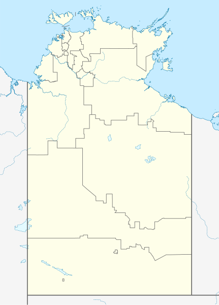
Quadratische Plattkarte, N-S-Streckung 105 %. Geographische Begrenzung der Karte:
Equirectangular projection, N/S stretching 105 %. Geographic limits of the map:
|
|
| Махуэр | ||
| КъежьапӀэр |
Уней лэжьыгъэр, using
|
|
| Лэжьыгъэр зи Ӏэдакъэ щӀэкӀар | NordNordWest | |
| Хуитыныгъэхэр (Иджыри зэ файлыр къэгъэсэбэпын) |
This file is licensed under the Creative Commons Attribution-Share Alike 3.0 Germany license.
 This file is licensed under the Creative Commons Attribution-Share Alike 3.0 Germany license.
|
|
| Other versions | Derivative works of this file: Australia Northern Territory with LGA names.svg |


|
This map has been made or improved in the German Kartenwerkstatt (Map Lab). You can propose maps to improve as well.
|
Файлым и тхыдэ
Махуэ/зэманым тепӀытӀэ файлыр дапщэщ сыт хуэдэу щытами уеплъынумэ
| Махуэ/Зэман | КӀэщӀу | инагъыр | ЦӀыху хэтыр | Гу зылъытапхъэ | |
|---|---|---|---|---|---|
| иджы екӀуэкӀыр | 13:50, 7 Мазае 2023 | | 1,134 × 1,577 (2.29 MB) | The2016 | Updated to current LGA boundaries. |
| 01:07, 5 Мэлыжьыхь 2010 |  | 1,134 × 1,577 (533 KB) | Chumwa | Reverted to version as of 16:37, 18 December 2009 | |
| 00:56, 5 Мэлыжьыхь 2010 |  | 1,134 × 1,577 (493 KB) | Roke~commonswiki | local government low salience, dont appear on general use maps | |
| 19:37, 18 Дыгъэгъазэ 2009 |  | 1,134 × 1,577 (533 KB) | NordNordWest | =={{int:filedesc}}== {{Information |Description= {{de|Positionskarte des Northern Territory, Australien}} Quadratische Plattkarte, N-S-Streckung 105 %. Geographische Begrenzung der Karte: * N: 10.6° S * S: 26 |
Файлыр къэгъэсэбэпын
Мы напэкӀуэцӀыр 1 тохьэ мы файлым:
Куэд къызэщӀиубыдэфыу файлыр къэгъэсэбэпын
Мы файлыр мыпхуэдэ викихэм къыщагъэсэбэп:
- Къыщыгъэсэбэпын af.wikipedia.org
- Къыщыгъэсэбэпын als.wikipedia.org
- Къыщыгъэсэбэпын azb.wikipedia.org
- Къыщыгъэсэбэпын ba.wikipedia.org
- Къыщыгъэсэбэпын bg.wikipedia.org
- Къыщыгъэсэбэпын ceb.wikipedia.org
- Къыщыгъэсэбэпын cs.wikipedia.org
- Къыщыгъэсэбэпын de.wikipedia.org
- Darwin (Northern Territory)
- Alice Springs
- Yulara
- Hermannsburg (Australien)
- Yuendumu
- Daly Waters
- Tennant Creek
- Darwin International Airport
- Katherine
- Jabiru (Australien)
- Palmerston (Northern Territory)
- Milikapiti
- Pine Creek (Northern Territory)
- Mataranka
- Vorlage:Positionskarte Australien Northern Territory
- Elliott (Australien)
- Timber Creek
- Wikipedia:Kartenwerkstatt/Positionskarten/Australien und Ozeanien
- Erldunda
- Papunya
- Kintore (Northern Territory)
- Adelaide River (Ortschaft)
- Haasts Bluff
- Yirrkala
- Ramingining
- Milingimbi
- Barrow Creek
- RAAF Base Tindal
- RAAF Base Darwin
- Kaltukatjara
- Benutzer:Rr2000/Vorlagentest Ort in Australien
- Connellan Airport
- Corella Creek
- Cape Crawford
- Borroloola
- Humpty Doo
- Batchelor (Australien)
- Kelly-West-Krater
- Maningrida
- Daly River (Stadt)
- American-Australian Scientific Expedition to Arnhem Land
Еплъын глэбальнэу къызэрагъэсэбэп мы файлыр.